Geospatial Tech for Building Resilience: GeoHub Workshop Strengthens Skills for Climate Disaster Management
Rose Waswa, of the Regional Centre for Mapping of Resources for Development in Kenya, participates in a session at the Geospatial Technologies workshop this summer. Photo by GeoHubs.
These events can be characterized as inherently spatial phenomena, meaning they are events with clear and observable boundaries. Geospatial data and technologies are extremely useful in analyzing and managing such events effectively, helping to ensure resilience in the face of similar disasters and shocks in the future. Resilience is the ability of a community or society to withstand sudden or chronic shock while at the same time recovering from and adapting to the effects of a hazard in a timely and efficient manner.
This summer, OSUN’s GeoHub Project, a joint initiative of Central European University (CEU), American University of Central Asia (AUCA), and Bard College, offered a Summer University workshop at CEU’s Budapest campus that focused on helping participants obtain the skills and knowledge needed to support such resilience on a larger scale. By several accounts, “Geospatial Technologies for Building Resilience” succeeded at helping OSUN faculty collaborate and develop capacities to implement the latest geospatial methods and technologies in their core research and share that knowledge in their teaching disciplines.
“There’s a lot to learn. So much is happening in different areas and getting all that information in one place and understanding who is doing what is as equally important as the actual individual work we do,” says workshop participant Rose Waswa of the Regional Centre for Mapping of Resources for Development (RCMRD) in Kenya, who says she benefited greatly from the collaborative aspect of the workshop. “Having a conversation on enhancing resilience and working together to achieve it is at the core of this course, which is better than providing solutions to problems we might not understand,” she added.

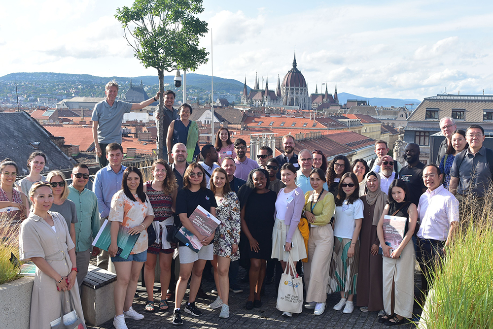
Participants in the Geospatial Technologies workshop gathered for a group portrait at the Central European University campus this summer. Photo by Geohubs.
According to workshop designers, geospatial technologies and remote sensing are critical for strengthening urban and rural resilience in the face of disasters and climate change. Such interventions take place at the intersection of economic, agricultural, and various social sectors, allowing for unbiased observation and analysis across geographical lines, national borders, and administrative boundaries.
But despite the growing diversity and accessibility of such tools, their successful implementation has been relatively limited, presenting a serious obstacle to disaster management. The immense amount of knowledge associated with ever-evolving geospatial technologies can be daunting to policymakers, presenting a significant gap between their tremendous potential and their actual application.
Engaging presentations, live demonstrations, and practical exercises at the workshop were aimed at bridging the gap between developers and practitioners, enabling participants to enhance their proficiency with cutting-edge tools and technologies that could be used for more informed and valuable data-driven decision-making. Some of the tools presented at the workshop include the Global Surface Water Explorer; FAO Hand-in-Hand Initiative's Geospatial Platform; Decision Support System for Land Degradation Neutrality; and Google Earth Engine.
Experts from specialized UN organizations, research institutions, companies, and academia came together to share their knowledge of the best applications of geospatial technologies to support endangered communities. Workshop faculty included representatives of the UN Food and Agriculture Organization (FAO), UN Office for Disaster Risk Reduction (UNDRR), UN Industrial Development Organization (UNIDO), UN Office for Outer Space Affairs (UNOOSA), World Bank/Global Environment Facility (GEF), European Commission’s Joint Research Center, European Space Agency (ESA), Yamaguchi University, AUCA, Babes-Bolyai University, Esri, and Google.
Lorant Czaran, a Program Officer at UNOOSA and co-director of the workshop, says it “brought together a small but diverse group of people, who within one week gain a lot of new information and open up their interests to these technologies and applications.” He says that one of the most important outcomes of the course is that participants take that information and use it to become ambassadors, “returning home to spread the knowledge to a variety of institutions.”
Beyond knowledge exchange and networking, the workshop formalized mutually beneficial partnerships, further extending the reach of the knowledge sharing. One example was the signing of a partnership agreement between the GeoHub Project and the Center for Research and Application for Satellite Remote Sensing at Yamaguchi University in Japan.
During the 2023/24 academic year, GeoHub continues its series of online and on site trainings and workshops in Vienna, Budapest, and Bishkek. The platform is open to any individual at an OSUN partner institution who has geospatial skills or is interested in developing such expertise.
Register for updates on upcoming GeoHub activities or write to [email protected].
Post Date: 08-29-2023